One of the most important things in aviation is having the right information at the right time. Yes flying skills are obviously good, but getting the right information for your flight is critical to making educated decisions instead of just guessing or not caring. One of the major factors in decision making is knowing the weather. Aviationweather.com is a certified source for accurate weather. One of the coolest tools is the Flight Path Tool.
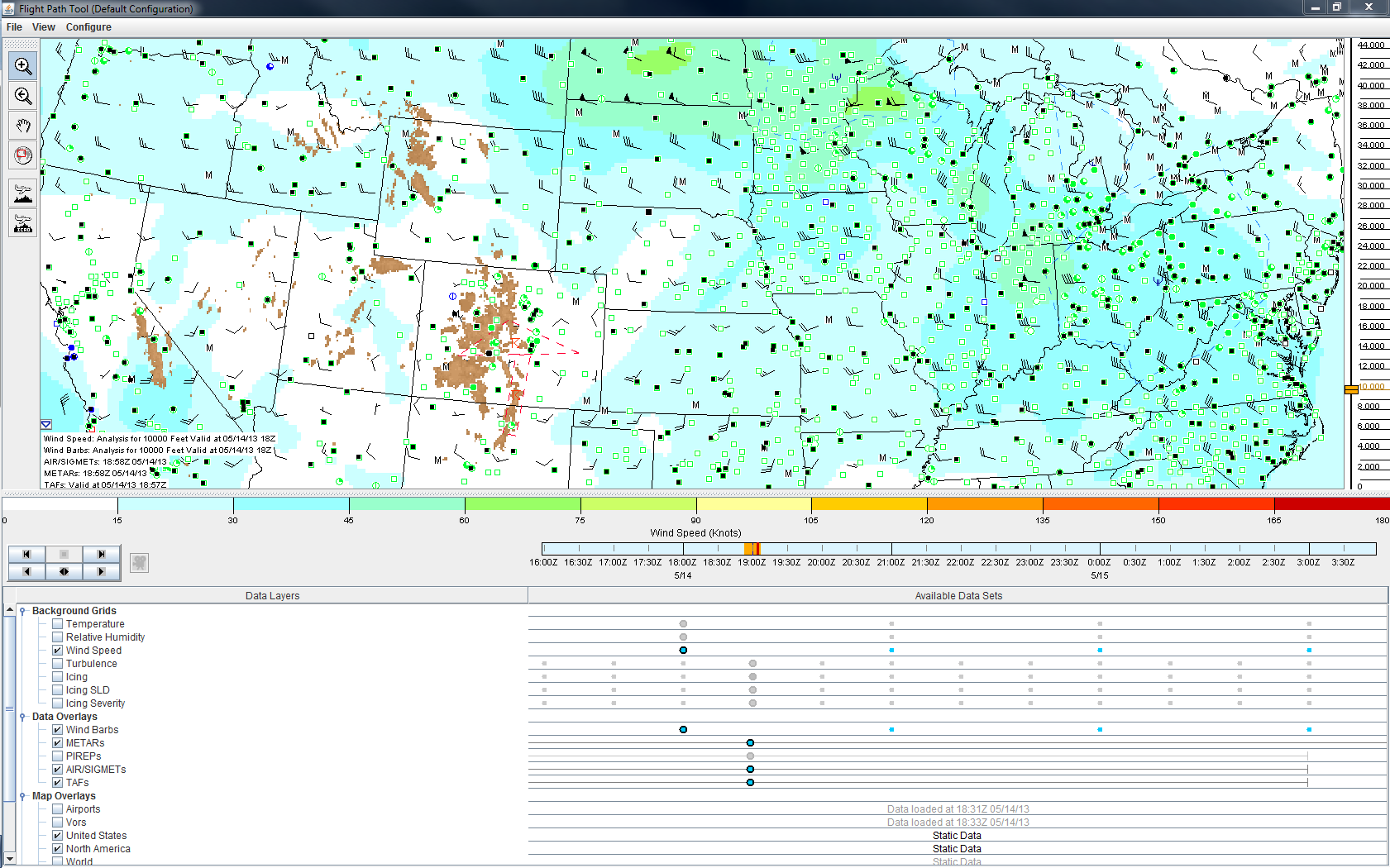
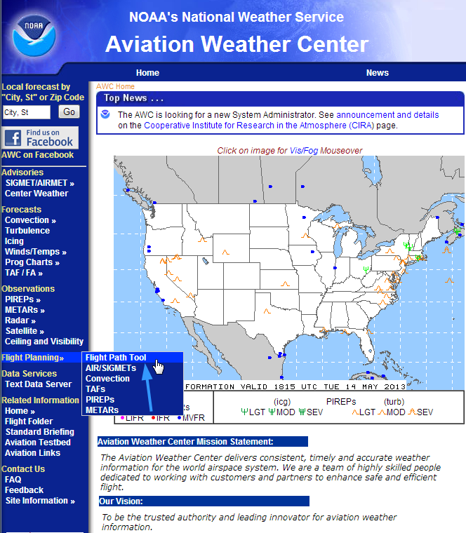
The flight path tool allows you to have a different java window open and look at all sorts of weather data at different altitudes, overlaid across a map. Everything from the Metar to TAF, wind and icing, this tool helps you see the big picture. It’s great having the information you need on a large map that is easy to access. The tool also displays a grid toward the bottom that indicates when the information was published and which information the map is using. Click on the image below to visit the page. Then click “Launch the new flight path tool Application”. Try it out and let me know if you like it!
If you have some down time, peruse through the website and see what other information you can find!